Case Study

AIXM & ARINC 424 powered Aeronautical Modules

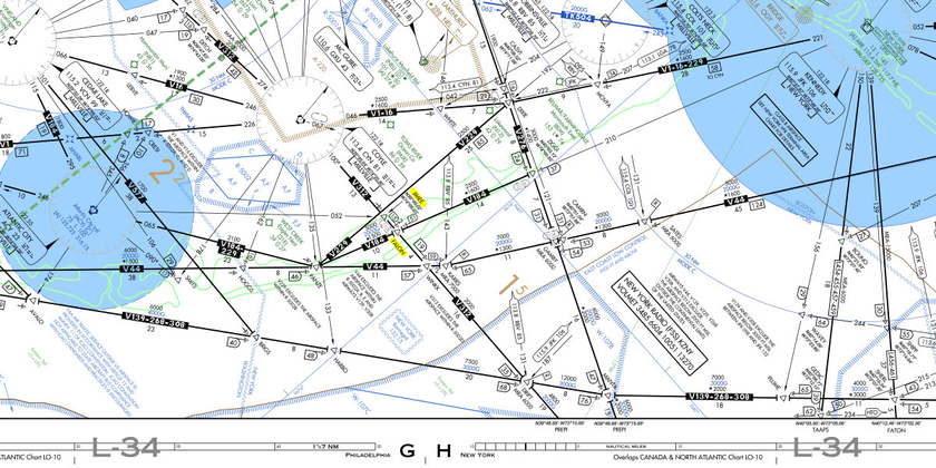
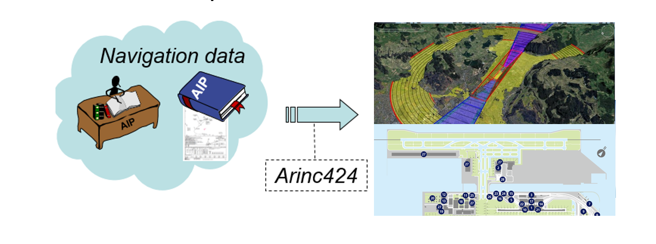
AIXM and ARINC 424 powered Aeronautical Modules The Challenge Reliance on static PDF and HTML formats for aeronautical information pose significant challenge, particularly in the absence of digital aeronautical data. This limitation hampers the creation of AIXM & ARINC 424 powered Aeronautical Modules, affecting real-time updates and interactivity. Such static formats do not provide the necessary dynamic information crucial for efficient flight planning and navigation, posing challenges for aviation professionals who require timely data for safety and decision-making. The consequence of this reliance on previous formats extends to a hindrance in the integration of digital aeronautical data with modern flight operational systems. This limitation stifles the progress of aviation technology, preventing it from creation of digitalized Aeronautical modules such as eTOD, AMDB, eCharting etc, aligning with global standards like AIXM and ARINC 424. To overcome these challenges and enhance operational effectiveness, there is a need to transition towards comprehensive digital aeronautical data formats. This shift ensures accuracy, timeliness, and the seamless integration of critical information, bringing the nation’s aviation industry in line with global technological standards. Our Role Cognitive Navigation’s Aeronautical Expertise played a crucial role in transforming India’s aeronautical information system. Recognizing the limitations of static PDF and HTML formats, we initiated a comprehensive solution. Firstly, we extracted and converted the existing static aeronautical data into dynamic digital formats, adopting the AIXM standard—a globally recognized model for aeronautical information exchange. This transition enabled real-time updates, providing Aviation professional stakeholders with accurate and timely information crucial for flight planning and safety. In parallel, Cognitive’s GIS Specialists spearheaded the development of advanced digital aeronautical maps. These maps offered improved readability and interactivity, addressing the challenges posed by static formats. By integrating cutting-edge technology and adhering to regulatory and industrial standards, Cognitive Navigation ensured that the digital maps met the highest industry benchmarks. Furthermore, it contributed to the creation of electronic Terrain and Obstacle Databases (eTOD) and Aeronautical Mapping Databases (AMDB), aligning with regulatory guidelines. This holistic approach not only modernized India’s aeronautical data presentation but also facilitated seamless integration into the global aviation ecosystem. The expertise provided by Cognitive Navigation significantly enhanced the efficiency, accuracy, and safety of India’s flight planning and navigation processes, marking a transformative milestone in the country’s aeronautical information management. Our Expertise Aeronautical Data Analysis Information gathering and sourcing Aeronautical Information Management (AIM) Geographic Information System (GIS) service Aeronautical Information Service (AIS) Process development Root Cause Analysis Research and Development

Aeronautical Maps – Enhanced Digitalization

Aeronautical Maps – enhanced digitalization The Challenge In the aviation domain, the reliance on aeronautical maps by operational stakeholders is indispensable for crafting efficient and secure flight routes. However, the exponential growth in aeronautical data has given rise to a significant challenge. Traditional static maps, while rich in information about airspace structure, navigation aids, terrain, and obstacles, struggle to maintain information priority standards, useability, interactiveness, regulatory standards and succumb to information clutter. This poses a real concern for aviation professionals, as the sheer volume of data presented in a fixed format can be overwhelming, making it difficult to discern critical details amidst the complexity. To address this challenge, there is a growing need for an interactive Aeronautical digitalized map. Such a dynamic solution would empower users, to selectively visualize pertinent information. By offering a customizable interface, this digitalized map would enhance clarity and streamline the interpretation of extensive aeronautical data. This transformative approach not only mitigates the challenges posed by static maps but also presents an opportunity to revolutionize the way operational stakeholders engage with and extract meaningful insights from the ever-expanding realm of aeronautical information, ultimately leading to safer and more efficient flight planning. Our Role Cognitive Navigation’s expertise in aviation domain demonstrated its commitment to excellence by providing Aeronautical and analytical expertise throughout the development of internationally competitive interactive aeronautical digital maps. We conducted in-depth analysis of complex aeronautical data to ensure accuracy and adherence to regulatory and industry standards. Our team spearheaded the creation of new functionalities, introducing innovative features that enhanced user experience and flight planning efficiency.Additionally, we generated new ideas to address challenges such as data clutter and readability issues. The team proposed solutions to optimize map displays, streamline information presentation, and improve overall usability. Cognitive Navigation’s GIS (Geographic Information System) specialists proved crucial in the development process. The team harnessed advanced GIS technologies to organize, analyse, and visualize spatial data effectively. This expertise facilitated the seamless integration of aeronautical maps with other Flight Operational systems and provided a foundation for the creation of adynamic, interactive mapping platform. By combining analytical prowess, innovative thinking, and GIS expertise, Cognitive Navigation’s Aeronautical team not only met but exceeded the needs. The resulting internationally competitive digital aeronautical maps set a new standard in precision, real-time updates, and user-friendly functionality for global flight planning. Our Expertise Aeronautical Data Analysis Information gathering and sourcing Geographic Information System (GIS) service Aeronautical Information Service Process development Root Cause Analysis Research and Development

Scroll to top